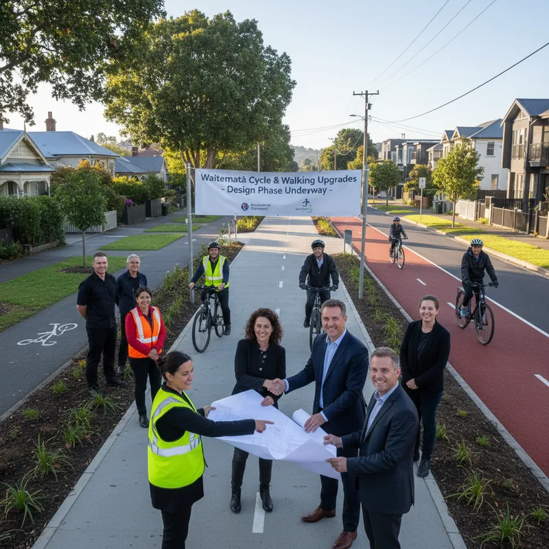
Auckland Transport has moved nine inner-city walking and cycling projects into the design phase.
The package targets seven corridors across the Waitematā Local Board area, from Meola to Westhaven through to Rose Road.
What is the waitematā local active modes plan?
Auckland Transport calls it a Local Active Modes Plan, or LAMP, a programme of “quick-win” upgrades for walking and cycling. It covers Herne Bay, Saint Mary’s Bay, Three Lamps, Westmere, Ponsonby, Freeman’s Bay, West Lynn, Grey Lynn and Arch Hill.
AT says the plan “was informed by the community and Local Board”. The agency lists the project start date as May 2024, with an end date of late 2026.
Project status on AT’s website now sits at “Design”, with feedback on initial designs closed. Public consultation for early information gathering closed on 31 May 2024.
Where will new walking and cycling changes go?
The plan has nine project sites grouped into seven focus areas. AT lists them as Meola to Westhaven, Westmere to West Lynn, Old Mill Road to Richmond shops, Franklin Road to Richmond shops, the Hepburn Connection, Crummer Road, and Rose Road.
Proposed design documents published by AT name specific streets, including Marine Parade, Kingsley Street, William Denny Avenue, Warnock Street, Francis Street, and Norfolk and Douglas streets. Other design packs cover Hakanoa, Cockburn and Farrar streets, as well as Chamberlain, Rose, Williamson and Hepburn.
AT has also published a “West Waitematā” project overview PDF and a boundary map for the plan area. The designs indicate the programme reaches into residential streets used as informal links between main routes.
When will waitematā LAMP works be finished?
AT says it hopes to complete the projects by July 2026. Its project page also lists the overall end date as late 2026, signalling commissioning and final delivery may stretch beyond physical works.
The agency says it is “now able to deliver these projects”. It has not published construction start dates for each site on the LAMP page.
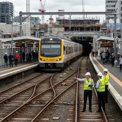
Residents tracking overlapping transport works may watch how this programme lines up with rail disruption and bus changes. Auckland Transport has already flagged a reset to its initial City Rail Link operations, outlined in our report on the plan to scale back initial City Rail Link timetables.
How the community shaped the plan
AT says it asked locals which streets and shortcuts they used, which routes they avoided, and where they wanted safety and accessibility upgrades. People could drop pins on an interactive map, email feedback, or attend sessions at Grey Lynn Community Centre.
AT’s timeline shows programme development completed in November 2024, with contributions “closed for evaluation and review”. The published plan, completed in April 2025, includes “a summary of all contributions collected as well as how community feedback shaped the recommended programme”.
Feedback on initial designs has now closed, but AT says it “will consult with local residents and stakeholders as projects from the Local Active Modes Plan are designed and delivered”. That phrasing suggests further street-by-street engagement as details such as parking, crossings and lane widths are finalised.
What it could mean for arch hill and grey lynn streets
The plan area includes Arch Hill, where residents already raise concerns about rat-running and pinch points on key links. Auckland Transport has previously catalogued congestion across the region, and our breakdown of Auckland’s worst traffic choke points shows how small street changes can shift pressure from one corridor to another.
Several of the named focus areas connect to destinations people walk to daily, including the Richmond shops and routes toward Westhaven. Those links also intersect with hospitality strips, where foot traffic often supports local trade, as mapped in our guide to best cafes and coffee spots in Arch Hill.
Waitematā Local Board will be watching how the active modes programme lands alongside big-ticket venue decisions elsewhere in the city. Auckland Council’s process for major facilities has drawn attention too, including a proposal for Western Springs, now headed to a council vote, covered by the Kiwi Herald in its report on the Western Springs Bowl plan.
Where to find designs and who to contact
AT has published separate PDF design packs for each project area, as well as a public feedback report and a frequently asked questions document. The project page was last updated on 12 March 2026.
Residents can contact AT through its engagement email, atengagement@at.govt.nz, or by phone on 09 355 3553. The plan sits within AT’s wider road safety approach, set out in its Vision Zero material.
AT says it hopes to complete the Waitematā LAMP projects by July 2026.